Grand Portage, Minnesota is located at the most northeastern corner of the state. We stayed at the Grand Portage Casino and Campground which is right on Lake Superior. We were going to stay here for a week, but only stayed 6 days, we got anxious to get to Jim and Bev's. Nice place, but with the wind and rain there was not too much to do.
One of the reasons we chose this area was to visit the National Park Isle Royale but the only way there is by boat. We arrived the Friday of Labor Day weekend and found that the last daily trip to the Park was the next day and it was fully booked. Needless to say we were disappointed.
 |
| Grand Portage Indian Reservation, Minnesota |
 |
| Our campsite was large and beautiful. We did not have any phone or Internet service at this campground which was the pits. It rained about every day, so the ground was always very wet and muddy. |
 |
| A boat ramp on Lake Superior. |
 |
| The view of the lake from our campsite. |
 |
| You are looking at Pete's Island just off shore from the campground. |
 |
- Grand Portage National Monument is a United States National Monument located on the north shore of Lake Superior in northeastern Minnesota that preserves a vital center of fur trade activity and Anishinaabeg Ojibwe heritage.
|
 |
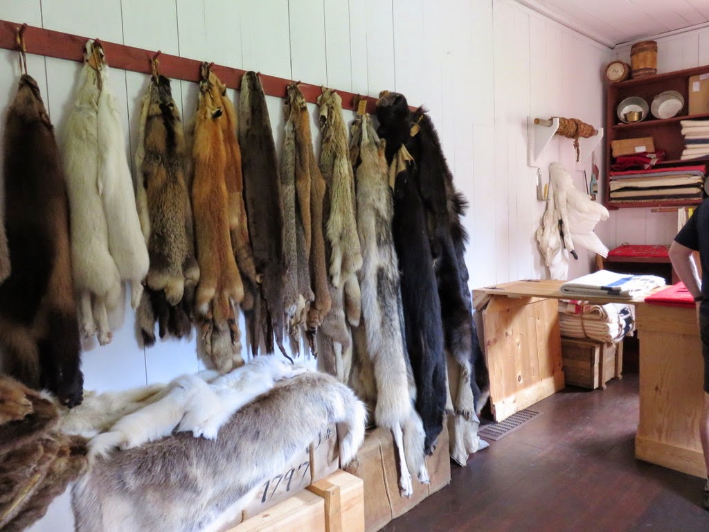
| The museum at the monument had lots of examples of the Ojibwe people's clothing and other articles they used. |
 |
| There were lots of examples of beautiful bead work. These gloves are just one. |
 |
| Kay on the path to the fort. |
 |
| Native America Ojibwe people structures outside the fort. |
 |
| At the Monument, the stockade wall, great hall and kitchen complex have been reconstructed over the original archaeological footprint from the late 18th century. These next pictures are from inside the stockade. |
 |
| This picture is from the road looking towards the stockade and Lake Superior. |
 |
| Looking out over the pigeon river where it flows into Lake Superior. |
 |
| Hiking trails extend along the banks of the Pigeon River, which forms the boundary between the U.S. and Canada. This picture is of High Falls which Kay and the dogs hiked to. I tried but my knee just didn't let me go all the way. |
 |
| We kept seeing these brown seagulls with the normal white ones and wondered if they were a different kind. Talked to a few people and found out they they are just the young seagulls. |
 |
| Sunrise over Lake Superior. |
 |
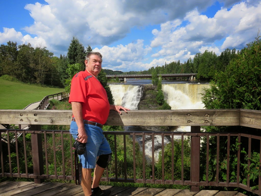
| We decided to take a drive up to Canada. The port of entry was only about 6 miles from the campground. Our first stop was Kakabeka Falls a waterfall on the Kaministiquia River, located beside the village of Kakabeka Falls in the municipality of Oliver Paipoonge, Ontario, 19 mi west of the city of Thunder Bay. It has been nicknamed "the Niagara of the North". |
 |
| Provincial Park Visitor Center |
 |
| We then drove into the city of Thunder Bay and down to the harbor. This light house was a long way off shore but not to back a lens on Kay's new camera brought it right in. |
 |
| An old grain elevator |
 |
| It started to rain while we were in Thunder Bay but we still could see the freighters out in the bay. |
 |
| On the way back to the US we spotted a sign for a cheese farm. They usually have great samples so we made a little side trip. |
 |
| Some garlic cheese and real maple syrup at the check out. |
.JPG) |
| Flowers and bugs always a good shot. |


.JPG)
.JPG)
No comments:
Post a Comment